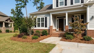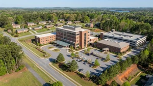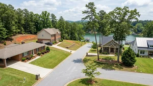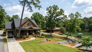
Lake Lanier sits roughly 45 to 60 miles northeast of downtown Atlanta - a massive reservoir that started life as a flood control and water supply project and turned into one of the most visited recreational lakes in the United States. For anyone looking at the Metro Atlanta area, the communities around the water draw serious attention, both for living on Lake Lanier and the outdoor access that comes with it.
The story behind the lake covers major engineering work, a 19th-century poet, and the deliberate flooding of entire farming communities. If you're considering buying here, understand what you're looking at when you stand on that shoreline. The nearby Gainesville real estate market currently sees a median sale price around $392,000, which reflects the area's steady pull for both year-round residents and second-home buyers.
Where Lake Lanier Is Located and the Counties It Covers
The reservoir covers a serious footprint in the northern part of the state, putting it squarely within the broader Metro Atlanta area. Its shoreline doesn't sit inside a single municipal boundary - the water and the land around it answer to multiple local jurisdictions.
Five distinct counties share the lake. Hall County claims the largest piece, about 60% of the water and shoreline. Forsyth County holds around 30%. Dawson, Gwinnett, and Lumpkin counties split the rest at 5%, 4%, and 1%, respectively. If you're shopping for property here, the county you land in matters - tax rates and zoning rules vary, and they'll affect what you can do with your lot.
Is Lake Lanier a City, Town, or Reservoir?
Lake Lanier is a man-made reservoir, not an incorporated city or town. When someone says they live "on Lake Lanier," their actual legal address belongs to one of the surrounding municipalities - Gainesville, Buford, or Cumming, for example. The lake itself is managed by the U.S. Army Corps of Engineers.
There's no mayor of Lake Lanier, no city council. Residents get their municipal services, schools, and infrastructure from their respective county or city government, depending on exactly where their property sits.
How the Reservoir Got Its Name
The official name is Lake Sidney Lanier, honoring the 19th-century Georgia poet and musician Sidney Lanier. He was a Confederate veteran who built a regional reputation for literary works documenting the local landscape.
His most recognized piece, "Song of the Chattahoochee," is literally about the river that was eventually dammed to create the lake. The U.S. Army Corps of Engineers chose his name to reflect the cultural history of the river valley. Most locals just call it Lake Lanier.
The Creation and Timeline of the Reservoir
Construction of Buford Dam on the Chattahoochee River wrapped up in 1956, which fundamentally changed the geography of North Georgia. The federal government officially dedicated the dam on October 9, 1957.
Filling the basin took time. The water reached its intended full-pool level on August 1, 1958. The project gave Atlanta a reliable water supply and hydroelectric power - and, almost incidentally, created one of the largest recreational lakes in the country.
The Submerged Towns of Oscarville and Murrayville
To build the reservoir, the government purchased and condemned thousands of acres of land in the river valley. That process put entire farming communities underwater, including Murrayville and Oscarville. Oscarville was a Black community in Forsyth County that had been founded during the Reconstruction era.
When the valley flooded in the 1950s, the water covered roads, buildings, and agricultural fields. Roughly 20 family cemeteries went under as well. That history hasn't faded - it's still a significant part of the region's cultural memory, and it shapes the way a lot of long-term residents think about the lake.
Historic Sites, Landmarks, and Museums in the Area
There are a handful of places nearby where you can dig into this history rather than just read about it. The Sugar Hill Historic Preservation Society operates a city history museum near the lake, and it has put together special exhibits on the construction of Buford Dam and the transformation of the river valley.
The other major landmark is the Lake Lanier Olympic Park in Gainesville. That facility hosted the canoe, kayak, and rowing events during the 1996 Atlanta Summer Olympics - not a small thing for a regional lake.
Modern Use of the Olympic Park
The Lake Lanier Olympic Park is now a working hub for water sports in North Georgia. It hosts rowing regattas and dragon boat racing events that pull competitors from across the country, and it's also open for recreational paddlers and community festivals.
The surrounding Gainesville housing market reflects how much that infrastructure matters to buyers - homes nearby spend an average of 76 days on the market, and access to facilities like the park tends to rank high on buyers' lists.
What the Area Is Known For Today
Ask most people and they'll tell you Lake Lanier means boating, fishing, and water sports. Its proximity to Atlanta makes it the default weekend destination for millions of people. The 1996 Olympic events gave the lake's reputation as a competitive rowing venue a permanent, international footprint.
The submerged communities add a layer that most reservoirs don't have. It's a place with a complicated history sitting right underneath the recreational surface, and that combination makes the region stand apart. The local real estate market reflects the demand - about 152 homes sold recently in the Gainesville area, with active inventory sitting at roughly 273 properties.
Frequently Asked Questions
What is Lake Lanier, GA known for?
Lake Lanier is known for its recreational boating culture and for hosting the rowing and kayaking events during the 1996 Atlanta Summer Olympics. It's also known historically for the submerged farming communities - Oscarville and Murrayville - that sit beneath the water.
What county is Lake Lanier, GA in?
It's not in a single county. The lake spans five different North Georgia counties: Hall County contains about 60%, Forsyth County holds 30%, and Dawson, Gwinnett, and Lumpkin counties share the remainder.
How did Lake Lanier get its name?
The lake is named after Sidney Lanier, a 19th-century Georgia poet and musician best known for writing "Song of the Chattahoochee" - a poem about the river that feeds the reservoir.
When was Lake Lanier, GA built?
Buford Dam was completed in 1956. The dam was officially dedicated on October 9, 1957, and the reservoir reached its full water level on August 1, 1958.
Are there flooded towns and historic structures under Lake Lanier?
Yes. The creation of the reservoir submerged farming communities including Oscarville and Murrayville. The flooding in the 1950s covered buildings, roads, and roughly 20 family cemeteries.
What historic landmarks and museums can you visit near Lake Lanier?
The Lake Lanier Olympic Park in Gainesville hosted events for the 1996 Olympics and is open to the public today. The Sugar Hill Historic Preservation Society also operates a nearby museum with exhibits on the lake's history and the construction of Buford Dam.
Are there other large lakes to consider near Atlanta?
Buyers looking for waterfront property north of the city frequently compare Lake Lanier and Lake Allatoona for their recreational access. Lanier stands out for its Olympic rowing history and massive footprint across five different counties.
Should I buy a second home on Lake Lanier or look further out?
Many second-home buyers evaluate Lake Lanier and Lake Hartwell when searching for waterfront property in the region. Lanier often appeals to those who want immediate proximity to Metro Atlanta and established infrastructure like the Olympic Park.